![]()
![]()
Idyllwild, CA
San Jacinto Wilderness, July 11, 12 & 13, 2001
Once again the sport/hobby of Geocaching brought us to a great new (for us) place to get away. Idyllwild is about a hundred miles north of San Diego and about 6,000 feet higher. It has restaurants and cute shops and a U.S, Forest Service Ranger Station where we stopped top ask a few questions before heading up to the "Wilderness". The Wilderness in this case was the Black Mountain Scenic Area in the San Jacinto Mountains. It's about 15 miles north of Idyllwild and 1,500 feet higher. The air was thin, clear and fresh; the sun was warm and the nights were cool. We stayed at Boulder Basin Campground about a half mile from the Black Mountain Lookout Tower and about three miles along a dirt road from the Pacific Crest Trail.


From left to right: Lorri and the sign along the road, Lorri and the van at our camp site, Lorri and the picnic table, the van hiding behind a boulder. The Campground had 34 sites of which only about six were occupied.
Black Mountain Cache - GCD22, July 11, 2001
About .4 of a mile from our campsite as the crow flies (and one mile as the person walks) was the Black Mountain Geocache.


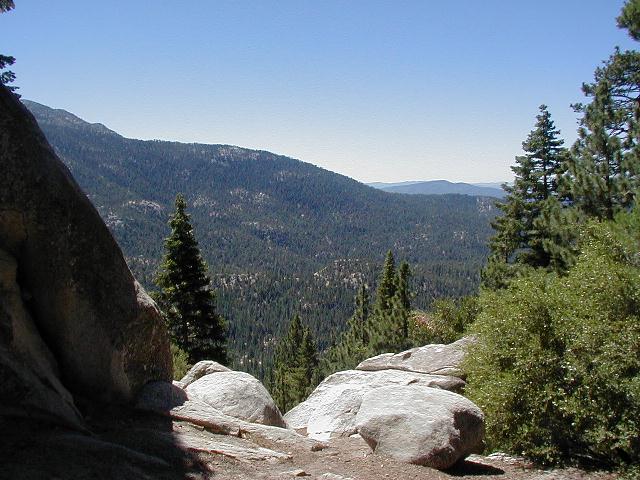
To get to it, find the campground sign (left), go up the dirt road (middle) and look for this view (right).
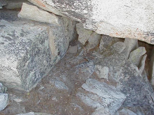
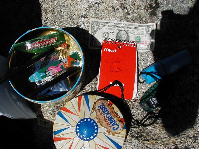

Look under a big boulder for some rocks and a pine cone (left), find the cookie tin (middle), sit and relax after all your hard work (right). If you look closely at the center picture, you can see the www.wheresgeorge.com dollar which I found at the Lake Hodges Picnic Cache and left here. I took a nice Coleman penknife key chain. Not a fair trade I know, but what the heck.


If you go to the cache, make sure you continue up the road to the Lookout where, if the skies are clear, you can see Hawaii and Colorado if you know where to look. Be sure and watch out for the attack lizard, though; he's a crafty little fellow. That's him on the right.
On Thursday, I decided to stroll down the dirt road toward the Pacific Crest Trail, which I found after a three-mile hike. It was a nice walk on the road. Only a couple vehicles went by. Below is a 250KB Topo! image of my stroll (in blue) and our meanderings around camp and the Geocache in red. The profile is of the stroll.


On the left is a great view of the Valley of Interstate 10 (I don't know its real name) and San Gorgonio beyond, and on the right is an interesting survey panel nailed to a tree along the road near its intersection with the PCT. There are a few things about this marker that a surveyor might find interesting. I'll be looking forward to emails from my sharp surveyor (oxymoron?) friends pointing them out to me. I'll give you one: It appears that it was originally posted on my birthday in 1935, which was many, many, many, many years before I was born!