![]()
![]()
Laguna Recreation Area, Cleveland National Forest
May 31 to June 2, 2001
Tired of the "June Gloom", the marine layer of clouds that covers coastal San Diego for much of the day in late May and June, we headed inland and up land to the Burnt Rancheria campground in the Laguna Mountains for a couple days. It's about 50 miles inland as the crow flies and around 5,500 feet elevation. The weather was perfect and I got a chance to hike a little in the Pacific Crest Trail as well as find another Geocache.

Here is our campsite. The campground was deserted on Thursday night and about a quarter full on Friday night. A few steps from our campsite was there was a trail that led directly to the PCT. I hiked from there to the top of Monument Peak and back, about a 7 mile round trip. The image below shows my trail as recorded by my GPS.

Note: this image is 460 kb.
Here are some photos from the top of Monument Peak


Like most local peaks of significance, Monument Peak is littered with a few microwave transmission towers. In the photos below you can see that they were even nice enough to post a warning to unwary hikers. In the photo in the meddle, if you look real close you may be able to see a couple workers about halfway up the tower. I figured that if it was safe enough for them, that I would be OK too. The photo on the right shows a close-up of a survey monument on Monument Peak. The "ECCENT" stamped on it means means that like most surveyors, the surveyor who set this monument was eccentric. Just kidding. (Only about 50 percent of us surveyors are eccentric, and proud of it).


Below are some shots taken along the trail.


The trail was nicely maintained and pretty gentle. The only steep part of the hike was the scramble up the Monument Peak on a side trail, not part of the PCT. On the way back, I cut over to Sunrise Highway for the last mile or two back to the camp ground. There was very little traffic. I passed a very inviting-looking roadside restaurant and "saloon" but much to my chagrin, it wasn't open.
Below is a photo of a lonely hiker on the PCT.

Hey! That looks like me!
The next day, Lorri and I decided to track down Laguna #1, a Geocache hidden on May 26, 2001. It was located about six tenths of a mile from where we parked, but we managed to turn the hunt into a three mile hike. It was as nice hike, though. This was Lorri's second find and my seventh. Below is a topo map with our course plotted.

Note: this image is 360 kb.


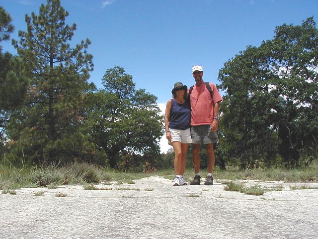

The two photos on the left were taken very near the cache hiding place. The two on the right were taken along an old road which is closed to traffic. It made for a very nice easy walk. This is a beautiful area.