![]()
![]()
South San Marcos
August 27, 2001
On the Road to Double Peak - GC81B
I set out this beautiful Monday morning to explore yet another new area (for me) of San Diego County. Starting from Lakeview Park and heading south, I soon found myself passing through a grading operation related to the San Elijo Hills housing development. Next I came to a big water tank hidden from view from below. Right near it is where I found the "Road" cache.

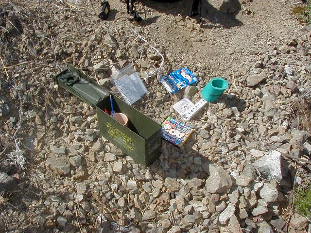

On the left is some grading. I love the smell of fresh dirt in the morning! I moved some of the survey stakes around a little because I've heard that's a nice thing to do. In the middle is the cache and on the right is yours truly holding the cache.
As I was leaving the cache I noticed a nice looking woman in shorts and bikini top with fierce-looking dog headed up the trail just ahead of me. She noticed me too and turned around and yelled "friend or foe?" What a silly question to ask! I looked around behind me to make sure she was addressing me and then apparently chose the correct answer, since she didn't complete the call on her cell phone, which she had to her ear, nor sick said dog on me. I explained to her what I was doing in the bushes off the trail (Geocaching in 25 words or less) and went on my way. My advice to lone ladies on the trail: if you're scared and have a dog, yell "This is a fierce man-eating dog named 'killer' who will defend me to the death if you come within 10 feet of me!" or, if you're not scared, a simple "hi!" will suffice.
Anyway, leaving dog lady behind, I trudged up to the top. The last few hundred yards on the fire road were the toughest. The rest of the trail was pretty nice.
San Diego Ocean View - GC140
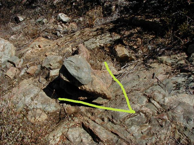


Here is the rock cairn with the arrow shaped rock. I added the yellow arrow for emphasis. Next photo is the hiding spot with helpful yellow arrow. Then the contents with Ernie and on the right, another self-portrait with cache.

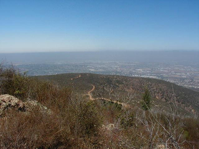
Here are a couple views from the cache site. One toward the San Diego Ocean (I always thought it was the Pacific) and the other toward Mt. Palomar. It was kind of hazy, so I didn't take too many photos.

After all my hard work, this is where I had my pb&j lunch. A nice shady spot with great views at the top of Double Peak. The End.